


Sailing Vessel Beruta Ship's Log
Neiafu, Tonga - Opua, New Zealand. All Points Rally.
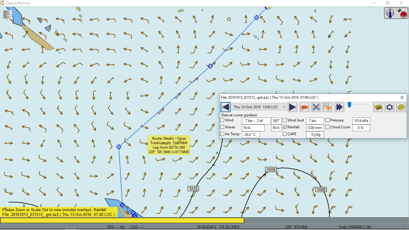
13 October 2016. Almost Friday...
This is the last long leg of the Pacific crossing for Beruta. It is close to 1,200 nm on a direct line but participants of The All Points Rally were instructed to aim at 30° S, north of the most northern cape of New Zealand, after passing Minerva Reef. The organizers reasoned it like that: it was much better to meet the low pressure system, i.e. the frontal system, north of 30° S because it was usually not as strong as it would be near New Zealand. Then when the front passed, the wind would change from NW to SW and a boat would tack and continue to New Zealand reaching or closed hauled but at least the wind wouldn't be on the nose as if it went straight to Opua.
As you see, this deviation from the direct course added an extra 150 nm to the passage. The idea was to make the voyage as comfortable and safe as possible, not necessarily fast. They did note that depending on the weather, sailors could cut the corners, of course, why not? After all, it was called a rally, not a race!
There were also briefings from New Zealand customs and biosecurity as part of The Neiafu Blue Water Festival. Officials explained the regulations and procedures. Particularly, it was important to clean the bottom of the hull, the bicycle and scuba gear for me. The food I cared less. Well, if they take something, it would not be the end of the world. I also had to email the customs the advance notice of arrival, which I did informing them of my coming to their pontoon in Opua marina on 24 October 2016 at noon. I would most likely have to update them via VHF radio on that.
In the morning I went to the market to buy fruits and vegetables, then took a taxi to the gas station and filled three canisters of diesel. For the check-out I had to dock to the fishermen wharf again. It was full. I mean it was occupied by two other boats. I asked the permission of the American cat Nauti Nauti to come along its portside. The lady did not mind. They were also checking out. The procedure was quicker than check-in and free. I had to pay something like $2.50 Tongan Dollars as a monthly harbour fee but the port captain wasn't there and the customs didn't care much.
My mooring buoy happened to be also free. It had an intriguing name "Private". Others had owner names (usually a company name like Beluga Diving) and VHF channels to call for arranging the payments. The owners did check them frequently. I actually expected to see a local guy one day or another but nobody showed up. So if you happen to be in Neiafu, look for it!
Once I got the clearance paper from the customs, I went off. It was 12:15 local time (UTC+13) or the New Zealand Day Saving Time.
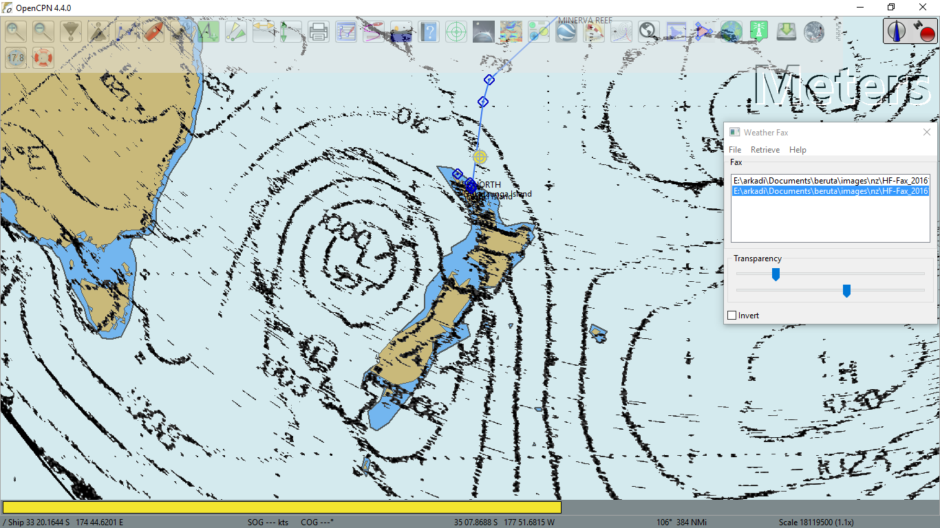
The weather was bad all the time for about three weeks. There was no wind around Tonga and too much wind around New Zealand. As you see, there is not much wind in the area this time as well. When I get to Minerva Reef in 4 days, it should be good easterly wind around 20 kts. There I would need to check weatherfax or HF broadcasts from Gulf Harbour Radio. As it stood from yesterday's forecast, it should be ok to continue to New Zealand. I would meet the low system around 30° S but the front seemed to be weak.
Speaking of weather situation, I forgot to get the fresh GRIB files on the day of my departure. I recalled it, when I was more than 5 miles away from the coast. Luckily, the 3G signal was still ok and from the second attempt I downloaded the 10-day weather forecast. And it did change since yesterday. Now the low pressure system was replaced by the high one on 22 of October. And it was quite high! The SE wind, produced by it near New Zealand was storm force: 40-45 kts! Hm... If that forecast stays, I definitely better wait in Minerva Reef for some time.
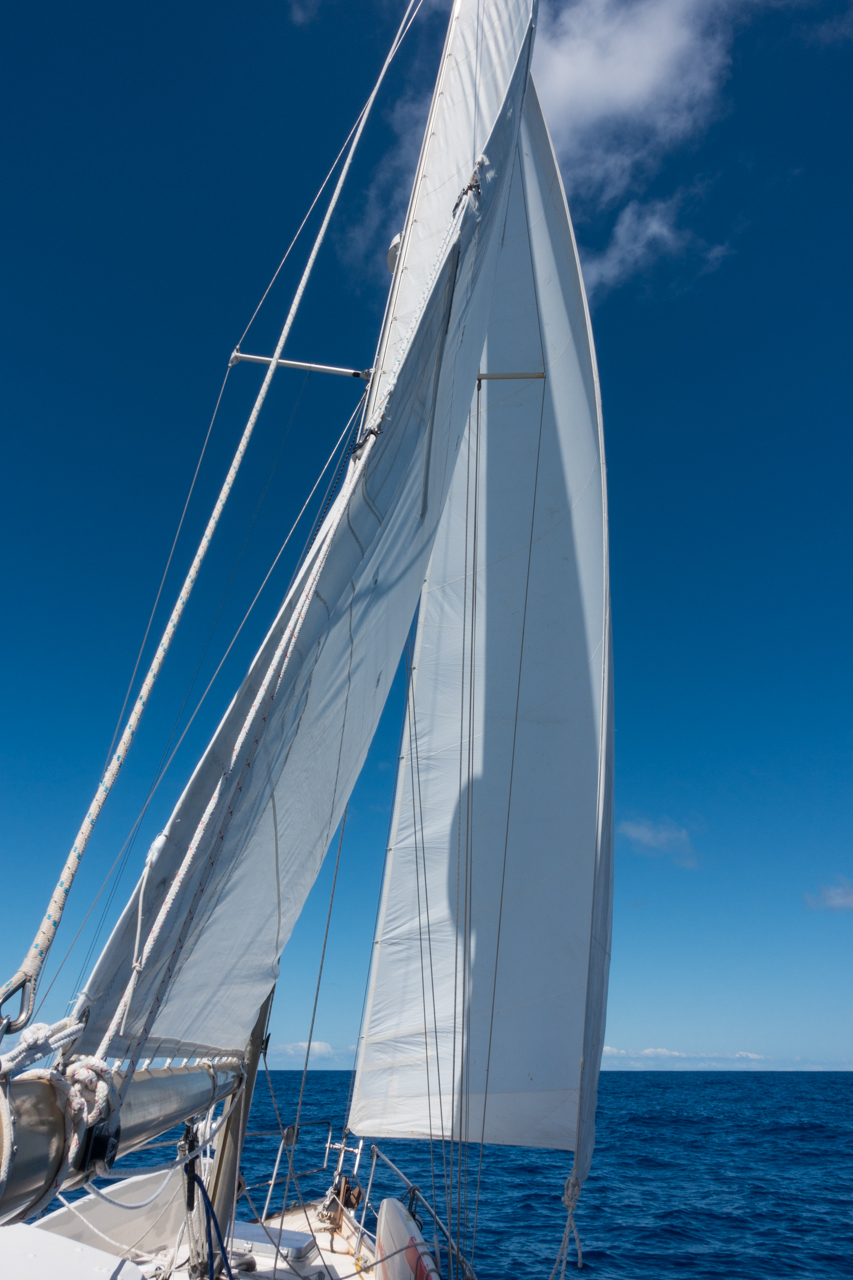
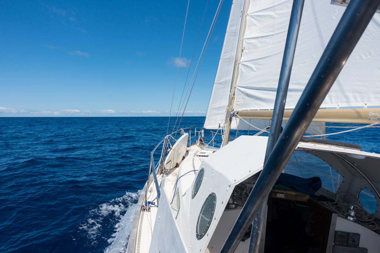
The day I left Tonga, the weather was good. Clear sky, 10-15 kts SE apparent wind. I set full main and genoa and was sailing close hauled 5-6 kts over water and 4-5 kts over ground. The current subtracted one knot! Damn it!
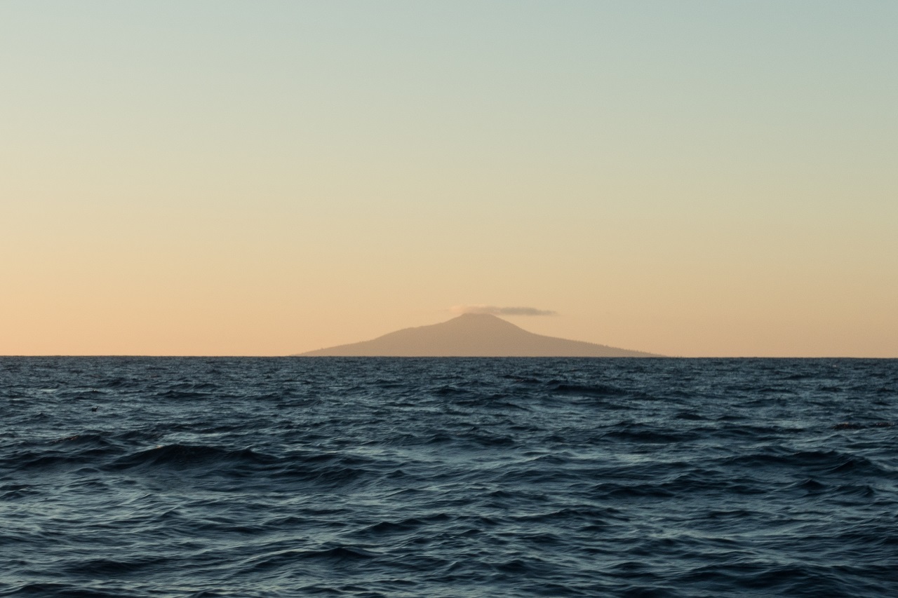
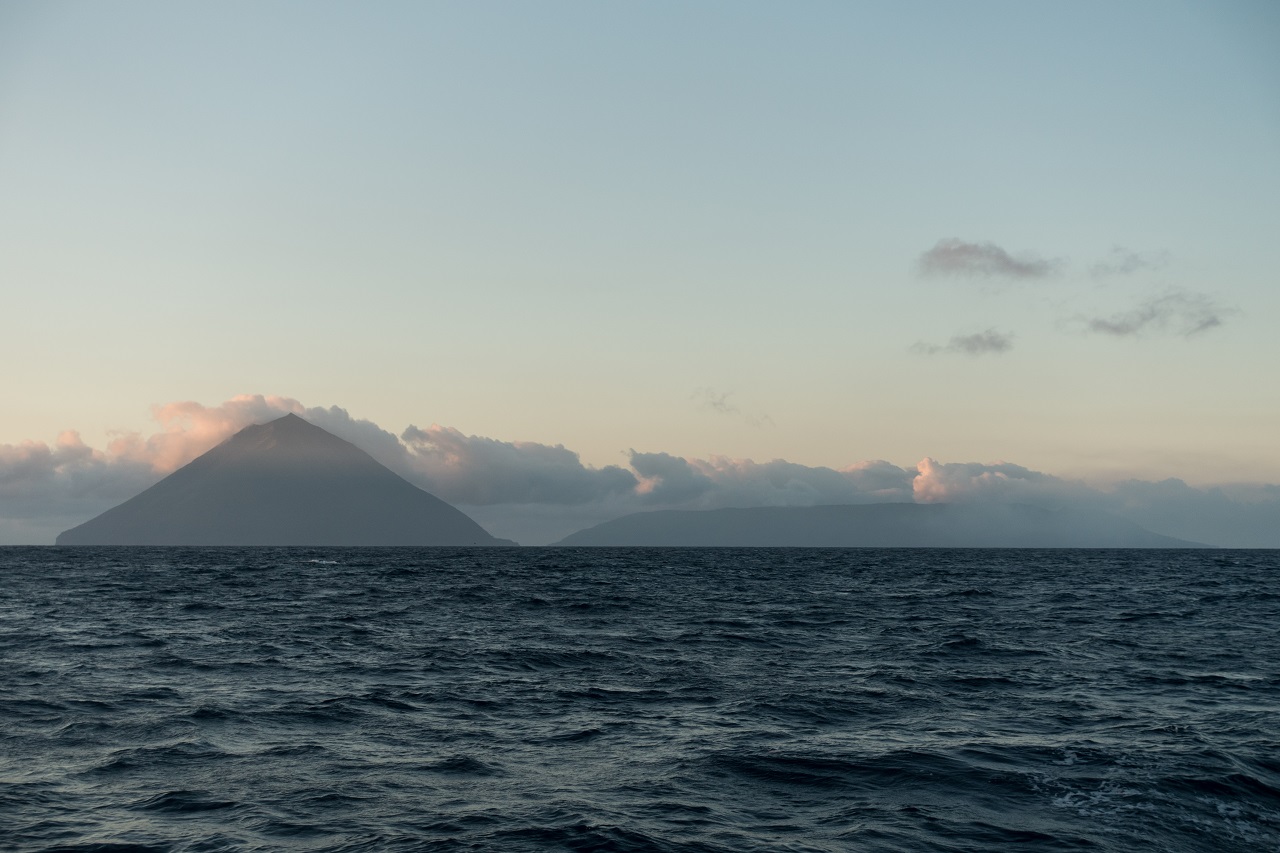
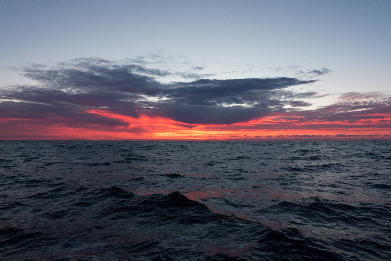
At sunset the Vava'u islands disappeared from the horizon. There was Late Island on my starboard. The dolphins came to say "Good night!". I had not seen those before. They were completely dark and their nose had a strange shape, not a bottle one.
14 October 2016. Friday
The night was relatively quiet. I ran the engine from 2 to 5 because the wind was weak and the current was drifting Beruta to the west of its 210° M course.
At sunrise I passed two uninhabited islands on my portside: Kao and Tofua, the last Tongan islands on my way to their Minerva Reef.
Beruta made just 106 nm for the first 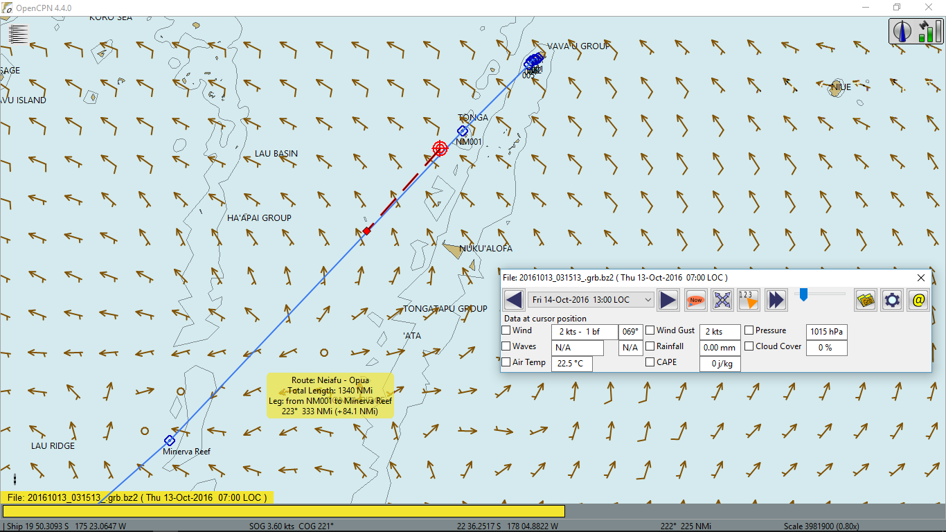 24 hours. 300 nm was left to Minerva Reef.
By the end of the day, the wind dropped to 5-7 kts and at 6PM I had to start the engine. This increased the wind to 9-11 kts. At 1,800 rpm both sails worked closed hauled and the speed through the water was about 5 kts. The current varied but seemed to have affected the speed over ground less than yesterday.
15 October 2016. Saturday
There was no wind at night. In the morning the surface of the ocean was like a mirror. Beruta was in the the center of the high pressure area. According to the forecast, I had expected to hit it later during the day but the area was broad.
I smelled a strange and familiar odor near the engine compartment but it was not the smell of Yanmar. Hm... Oh, yes, the batteries! It was a mix of probably hydrogen and sulphuric acid vapors. I cleared the access to the battery compartment and one of three house batteries was cooked! It was very hot and half of the electrolyte evaporated.

I noticed a strange behavior of the voltage meter a day ago. When the engine was running, its hand trembled near 14.5V. The tachometer hand also trembled. It was somehow affected by the voltage. I had even thought that a voltage regulator of the alternator was malfunctioning. When my starter battery died a little while ago, both hands did the same. I had disconnected the starter battery at that time, it had a shortened cell, and everything went back to normal. I guess the same thing happened. The voltage hand did not tremble anymore and the voltage itself dropped to 14.0V meaning that the battery cell was shortened. I disconnected the cooked battery and voltage got back to 14.4. I had to open all the hatches to ventilate the cabin. Luckily, the was no wind and waves. I checked the electrolyte level in the remaining batteries. It was good. I topped it a bit in one of them. Now I had only two working batteries left in the house bank and no starter battery at all. Oh, well. Hopefully, they would survive for another 8 days or so till I reach New Zealand.
I tried to get a weather forecast using my SSB receiver. I barely heard the Gulf Harbour Radio. A weather fax signal from New Zealand was also terrible. I hoped that when I get closer, it would be better. It seemed though that a high pressure area was about to arrive to the north of New Zealand tomorrow and that would create a good easterly wind. It was expected in my GRIB files. So the forecast held for now.
For the last 24 hours Beruta sailed and motored 112 nm. Its position at 12:10PM local time can be seen on 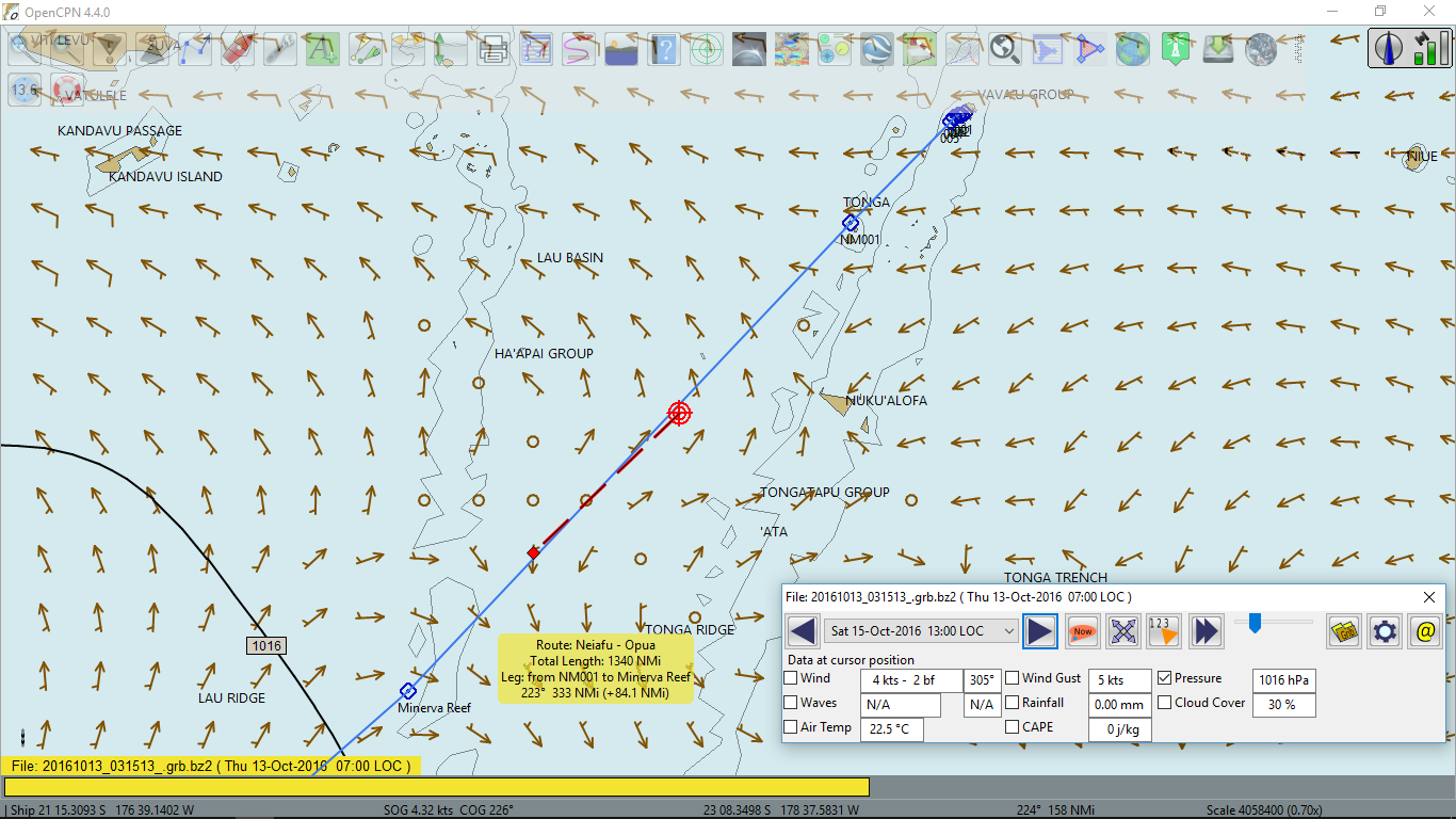 this chart.
Since the beginning of the voyage Beruta was occasionally sailing through muddy waters. The polluted areas were huge. Where all this shit was coming from?
16 October 2016. Sunday
I spent most of the night trying to receive decent weather faxes, especially those with 30, 48 and 72-hour forecast but no luck. The signal was bad. The only readable picture was from 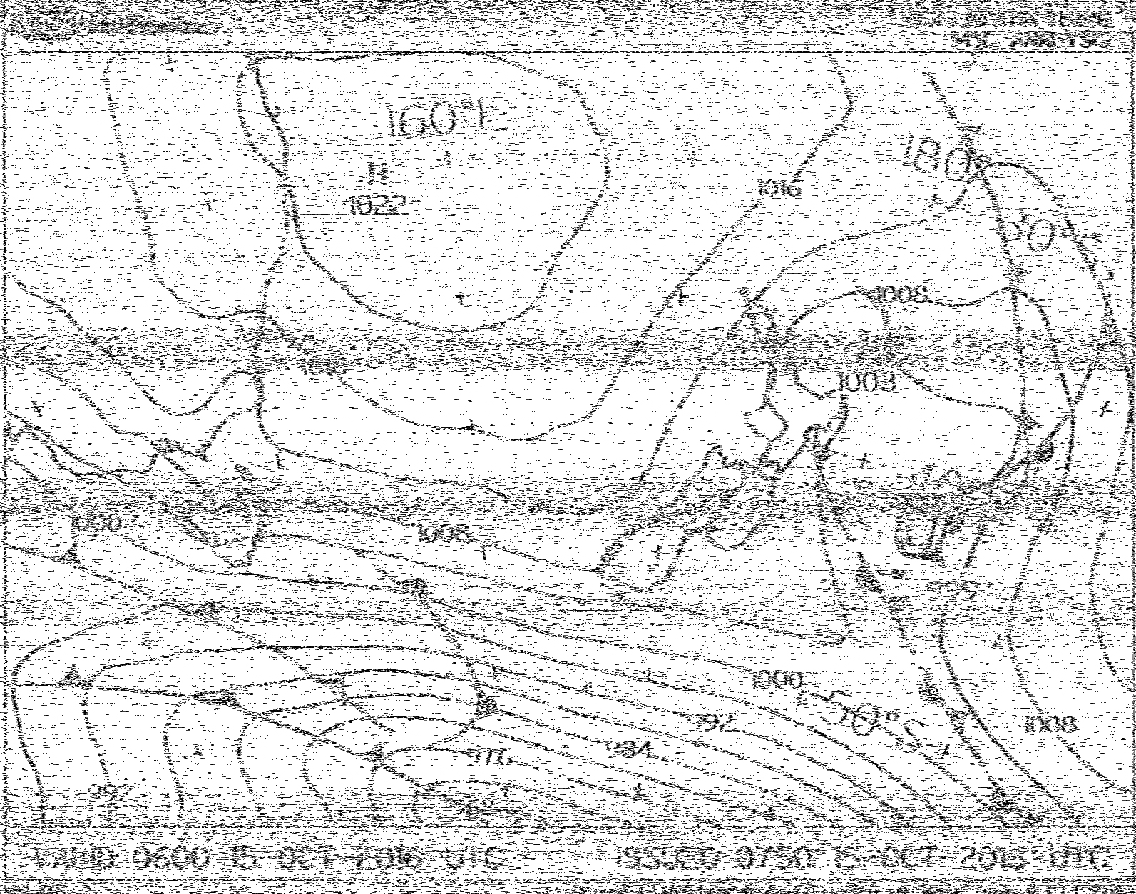 6:00 UTC analysis, which correlated pretty well with
 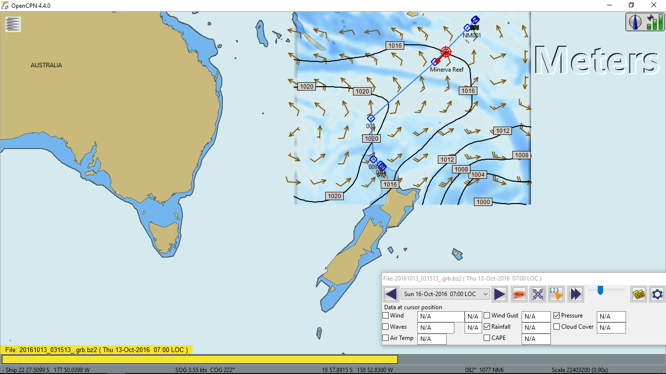 the GRIB file that I had downloaded on the departure day.
There was no wind till 7:00. I motored for the last 39 hours non-stop till 9 o'clock. The wind was still weak 7 to 12 kts apparent from SE. The course was close hauled, 40 to 60 degrees on the port tack. The current was brutal, more than a knot! Beruta was bearly moving over the ground, 3-4 kts. Interesting that 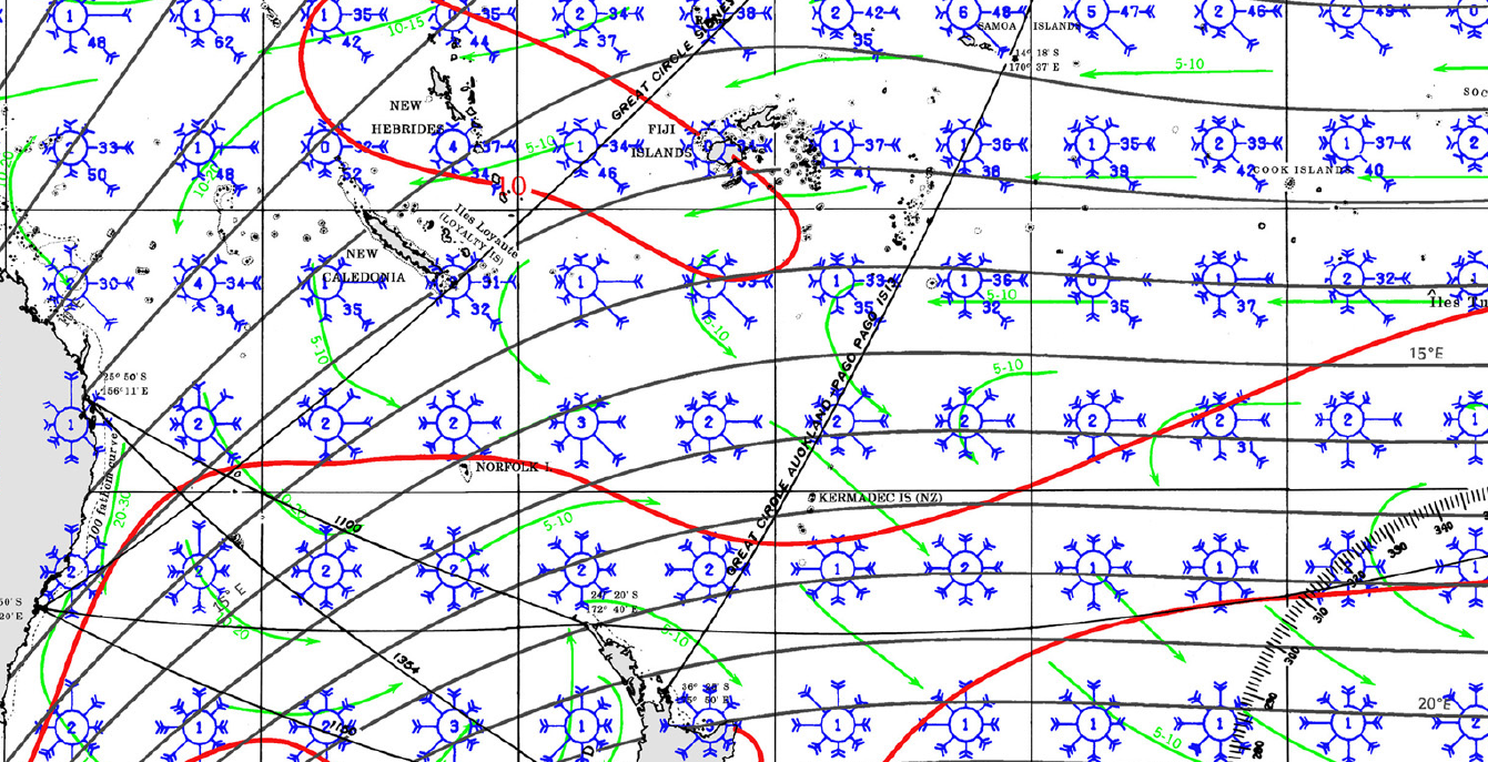 the pilot charts did not display this head current. See the green arrows. The numbers are the minimum and the maximum drift in nautical miles per day.
Yesterday, when I disconnected the cooked battery, I had not moved the voltage regulator sensing wires to the other battery. I noticed it only today when the voltage jumped to over 15V! First, I hadn't realised what caused it. I just rotated the solar panel away from the sun and thought to deal with it later. When I was writing about it in this logbook, it suddenly struck me that those wires were from the charge controller and not from the voltage meter!
Beruta covered another 96 nm. At 12:15 her position was shown on 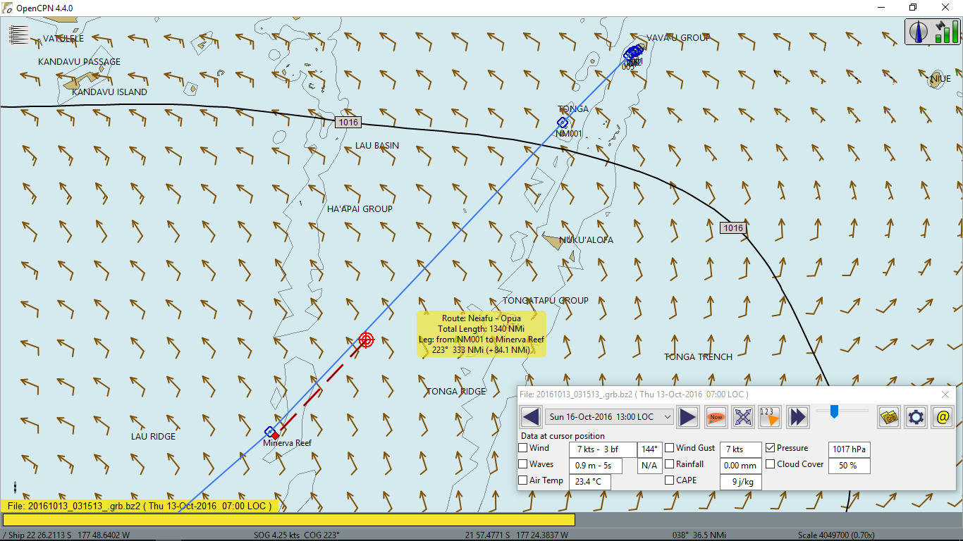 this chart. 93 nm left to Minerva Reef.
Afternoon, the clouds intensified and the wind started to pick up to 16 kts, the time to think of replacing the genoa with the jib and taking one reef on the main for the balance. When it gusted to 18 kts, I did it. The wind further increased to 20-22 kts. Beruta was quite close to the wind, 40-50° on the portside. To avoid pounding, I had to replace the jib with a storm one and take another reef on the main.
It was the tail of the cold front that had passed New Zealand some time ago. Nothing major, just cloudy and windy. No squalls or showers. Cold though. Coconut oil solidified. It had always been in a liquid state in tropics, which had ended at 23°28' S latitude, the tropic of Capricorn.
17 October 2016. Monday
I spent all night receiving weather faxes again. The schedule was not very convenient. The New Zealand MetService transmitted a weather chart 4 times within one hour, every 15 minutes, each time on a different SSB frequency: 5,805.1, 9,457.1, 13,548.6, 3,245.5 (or 16,338.2 day time) kHz. The 30-hour forecast began at 1AM, following by 48-hour one at 2AM and 72-hour prognosis starts at 3AM. I was lucky if one out of 4 was readable. Tonight they were. Give or take, they matched my old GRIB file. Another words, the high pressure area would dominate north of New Zealand for the next three days, meaning good sailing weather for me. Therefore, I would not stop at Minerva Reef.
Clouds began dissipating in the morning and the wind became 10-12 kts ESE varying from 60-90° on the portside. I hoisted the jib and full main. When it became 15-18 kts, I took the reefs again to reduce the weather helm. I switched to autopilot because the wind was unstable, both in terms of the direction and the strength. Otherwise, I would need to adjust the windpilot often.
I listened to The Gulf Harbour Radio at 8:15 on 8,752 kHz. One of the boats was going to arrive to The North Cape of New Zealand on Friday. The forecast for her was SSW 15 kts wind after the weak cold front, so the old forecast still held. I would be at 30° S north of New Zealand at that time, which is not bad.
At 10AM I passed The North Minerva Reef, the 3 mile in diameter mouth of an old volcano at the sea level, at a distance of half a mile. I did not see any boats there. The South Minerva Reef was 20 miles down my route. I left it to the portside at 2PM.
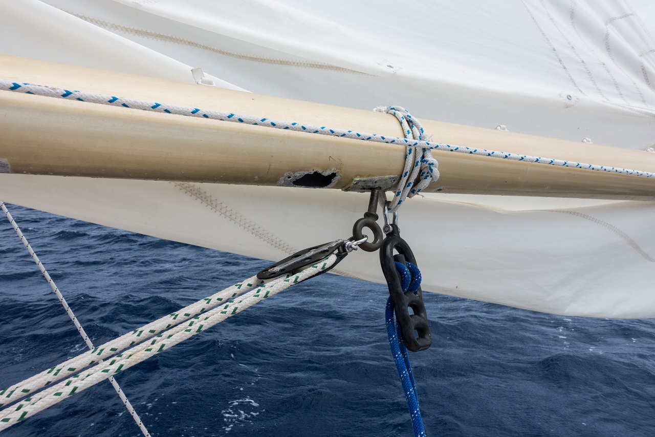
The boomvang stainless eye-bolt attached to the boom broke again. I replaced it with what I had, a large bronze one. I need to do something about it. I forgot now how many times the boomvang had broken in the past.
At 12:30PM Beruta was between 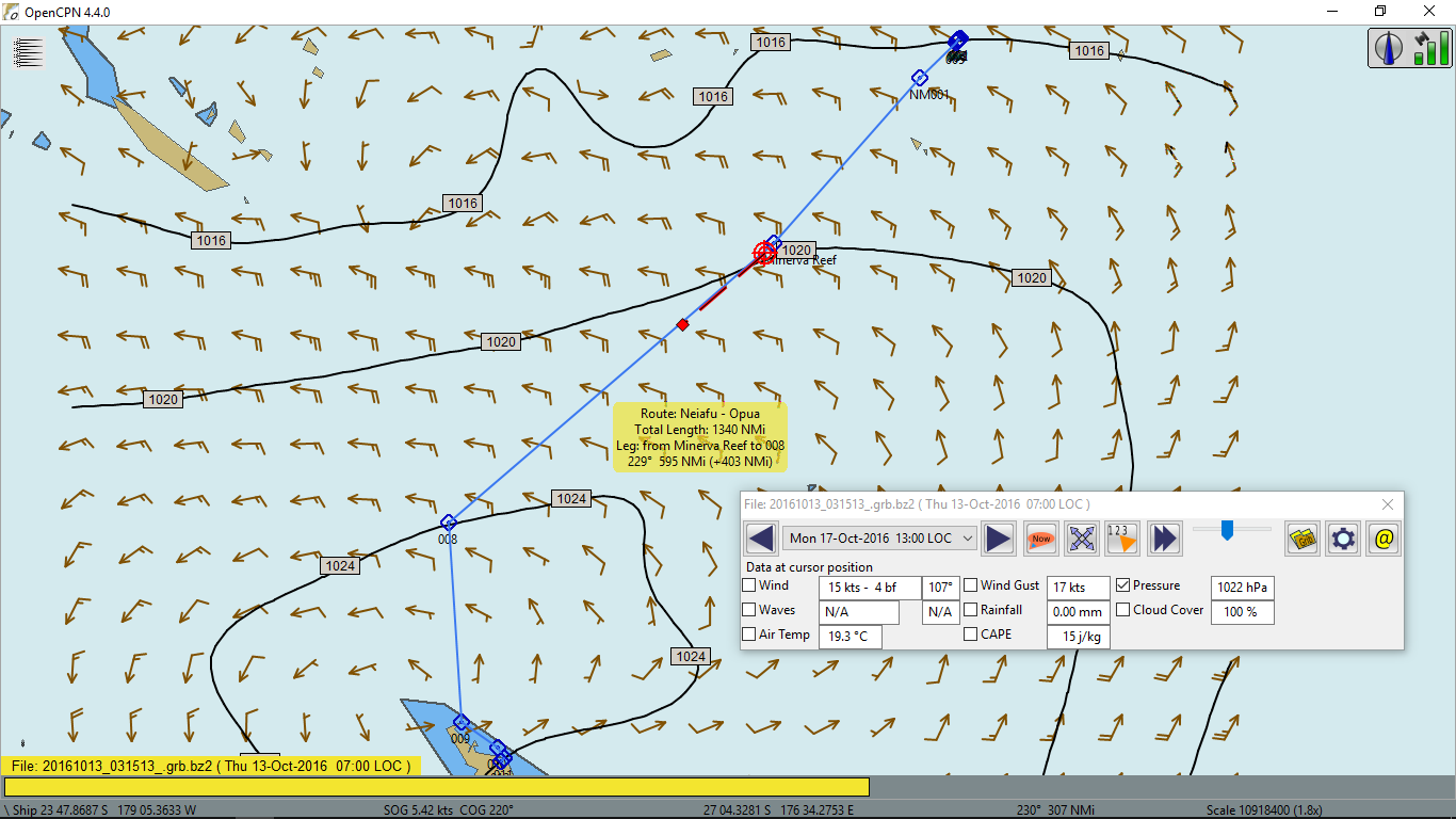 The North and The South Minerva Reefs. She made 106 nm since yesterday. Almost 900 nm left to Opua. Hopefully, I could make it in one week.
18 October 2016. Tuesday
The trough coming from Fiji to the east, was causing cloudiness and even light rain this morning. The wind early in the morning died to 10 kts, so I took the reefs off but then it picked up again to 20 kts, making me take the reefs back.
Today I heard The Gulf Harbour Radio very good, although there was little information for me there. I thought that I should have emailed them before the voyage and asked to include me in their weather updates for my route. Unfortunately, there were no other boats near me. I should invest in SSB transmitter in the future.
When the wind calmed down again later in the day, I wanted to take the reefs off but the main halyard stuck almost at the top. It did go down and up but to a certain point and I felt lots of friction in its movement. I lowered the main completely and using the spare line, checked the entire halyard. It was good. It seemed that it jumped from its reel to the toping lift's one. I had to climb up the mast. It was rolling. When I got up, I found that I was correct. The plate that divided two reels was broken and if I recalled right, it had been broken when I last time was at the top of the mast back in Panama. And now what should have happened, did happen. I left too little play in the main halyard and therefore, was not able to move it back to its reel. Even if I did, it might slip back easily. I should have fixed the separation plate first. I doubted that I could have done it at sea.
At the moment I was sailing down wind, broad reaching. This would continue for a day or two. For the time being, I decided to sail under a jib or a genoa, and if it would stop rolling, try to fix the halyard. Tomorrow or a day after, I might be in the center of the high pressure system and possibly there would be less sea motion.
For the last 24 hours Beruta passed 121 nm. You may see her position at 14:20 at 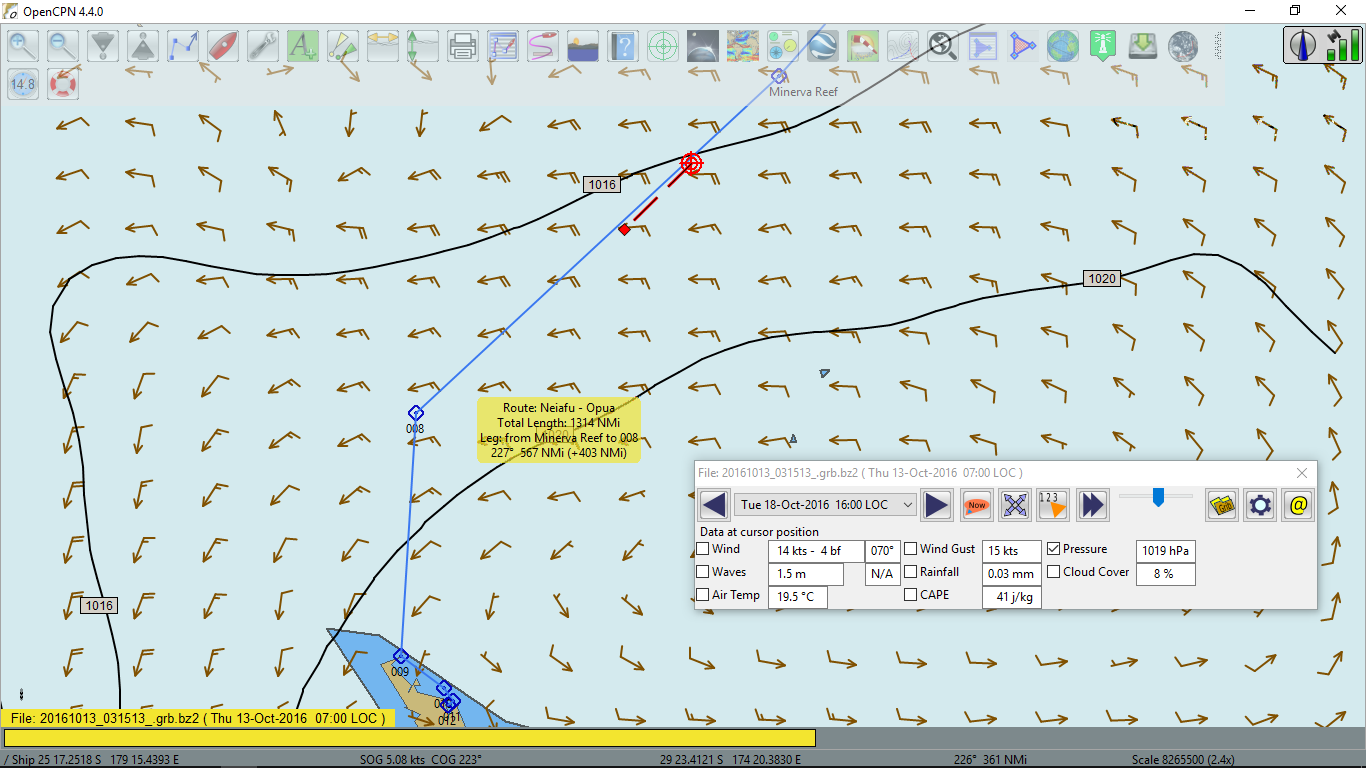 this chart. The wind strength is not correct there. It is 5 to 10 kts less. As you may see, I crossed the 180° meridian and hence, moved from the western hemisphere to the eastern one.
The farthest east I was in Marmaris, Turkey in September 2011, which was at 27° E. Therefore, more than half of the Earth I have already navigated, not circled yet but I will be there one year or another. I am not in a hurry.
At 8PM I started the engine. The wind was variable on the portside 6-8 kts and one genoa was not enough to run faster than 3-3.5 kts.
19 October 2016. Wednesday
At 6AM the wind became little stronger, or should I say sharper? It blew at 60 to 80° and appeared to be stronger, around 12 kts. I stopped the engine, had breakfast and did what I thought might be a solution to a broken main halyard.
The solution did work! It avoided me hanging and swinging at the top of the mast 12 meters above the sea level. The wind was light but the seas were not. I had two blocks, which I used sometimes for spinnaker sheets. I removed the main halyard to free the topping lift. Then I raised these two blocks on the topping lift. I used the main halyard for the topping lift, since it was longer, and a spare halyard as a main halyard. These two lines were passed through the blocks prior to raising them, of course. The new main halyard was short and I had to hoist the main at the mast but that was not a problem. I was back with two sails again!
I sailed under full main and genoa till 10AM. I checked the fuel. I ran the engine total for 58 hours and it used 17 gallons of diesel, which translated to 0.29 gallon per hour at 1,800 rpm or 1.1 liter per hour. I topped the tank with three canisters. 2 more canisters remained full, totaled 40 gallons. If usable were only 35 gallons, then I had enough diesel for 120 hours or 5 days of motoring.
At 10AM the wind became light again, 4-5 kts and I began counting the hours down. Two hours later, the wind blew steady 10-15 kts. I stopped the engine, took one reef on the main and then replaced the genoa with the jib. I was reaching at 5-6 kts. The current seemed to have been on my side now. It added 0.2-0.5 kts to the through water speed.
Today Beruta covered another 112 nm. Her position at 12:30 can be seen on 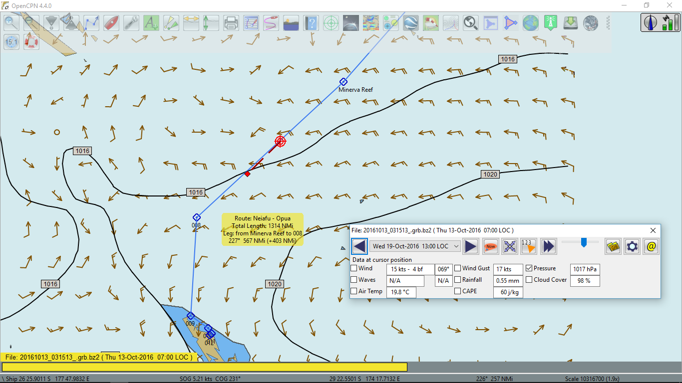 this chart. A half way left to New Zealand.
Later in the day the wind increased to 15-20 kts, so I took another reef on the main.
From 13:00 to 16:00 I was trying to receive weather faxes. I was able to read 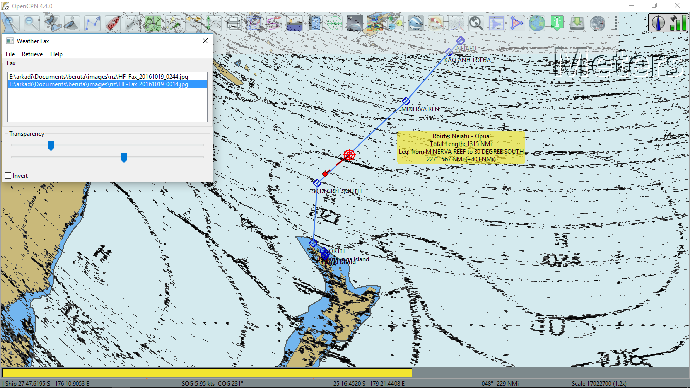 the 24 and
  72-hour forecasts.
As you may see, tomorrow I will be going through the high pressure area. And on the 22 of October there will be another anticyclone system. In between these two highs, there will be a low with some weak occluded and cold fronts, which I guess, will cross my route sometime on October 21. Not bad, not bad.
20 October 2016. Thursday
The night was quiet. The sky cleared by the morning as expected. My barometer showed 769 mm or 1,025 mb. The wind became very light and at 9:00 I had nothing to do but start the engine and create the wind. I also took off the reefs and set the genoa. I was motorsailing at 1,800 rpm with a speed of 5.5-6 kts.
I heard on the Gulf Harbour Radio this morning that the next front would pass the New Zealand on Monday, October 24. I had planned to arrive on that day at noon. Now my ETA looked like late Monday or Tuesday. Another words, I would meet this front near the coast of New Zealand. That might not be too bad because I would be under the protection of the land from NW and SW winds. The only problems would be a bad visibility, a high wind and a rain. I should try to cut the corners and arrive to Opua before the front. At the moment, I was still motorsailing close hauled on 220° M course. Going straight to New Zealand would be against the south wind.
I also heard that a group of 4 boats including Canadian Blown Bubble with the captain named Cal, that I met in Palmerston atoll, gathered at Minerva Reef today. They picked bad timing in my opinion because they had gone through the trough from Fiji a day or two before with the wind gusting to 40 kts and now they had to wait for a few days for the forming in the area depression to move east before they could sail to New Zealand.
Beruta made 133 nm since yesterday and 786 nm since the beginning of the voyage one week ago. This made 112 nm on average per day or an average speed of 4.7 kts. 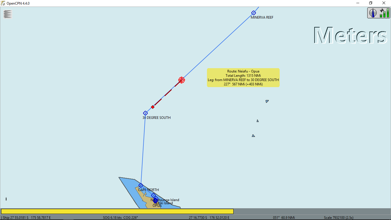 Here was her position on the chart at 12:30.
Afternoon I received radio faxes. Indeed, 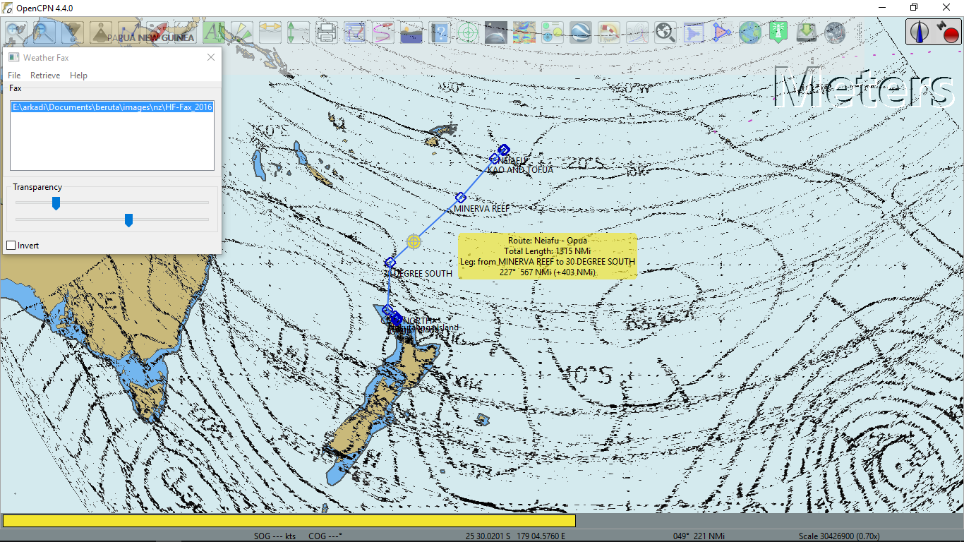 the weak occluded front would cross the 30° S waypoint tomorrow around noon. The following day
 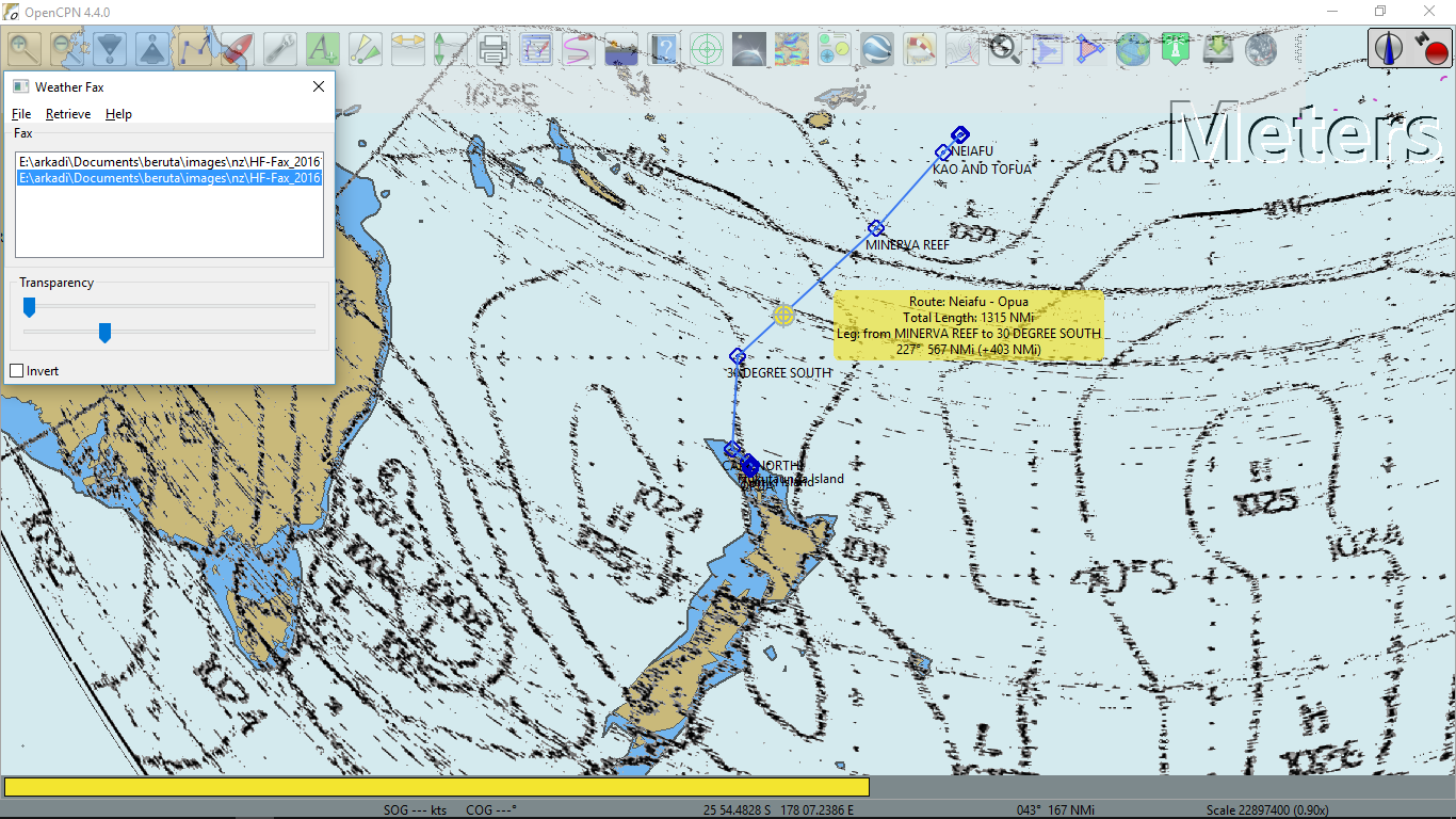 the high pressure area would approach New Zealand from the west. It would create hopefully light but unpleasant SE head wind. And for Sunday, October 23
  the low would approach New Zealand from the west. This low would create the front that Gulf Harbour Radio mentioned for my arrival on Monday.
At 20:00 the wind became favorable to cut the corner. I changed the course to 185° M to Cape North. 175° M would lead directly to the Bay of Islands. Unfortunately, the wind veered back to south. It was no more than 10 kts on the bow, so I increased rpm to 2,000 and continued motoring.

21 October 2016. Friday
In the morning the wind increased further to 10-15 kts and I revved Yanmar to 2,200 rpm, trying to maintain the 4-kt speed. Well, sooner or later, likely tomorrow night, the high pressure would pass and the wind should gradually change to NW.
The signal of the Gulf Harbour Radio was weak today because I was getting close to 30° S. They said that south of this latitude was a skip zone for 8MHZ frequency.
Beruta motored 114 nm for the last 24 hours or 900 nm from Neiafu.  Here was her position at 13:50. 300 nm left to Cape North.
Here were afternoon radio faxes: 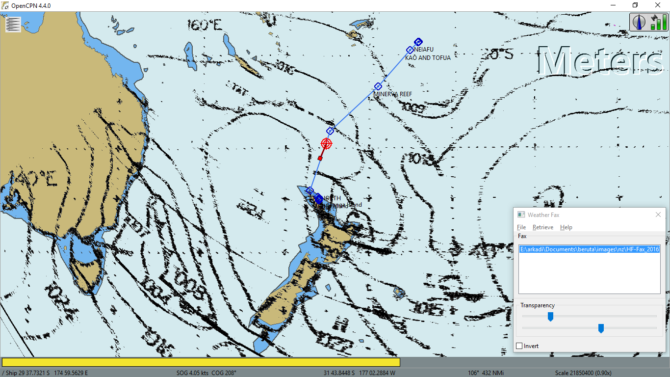 24-hour,
 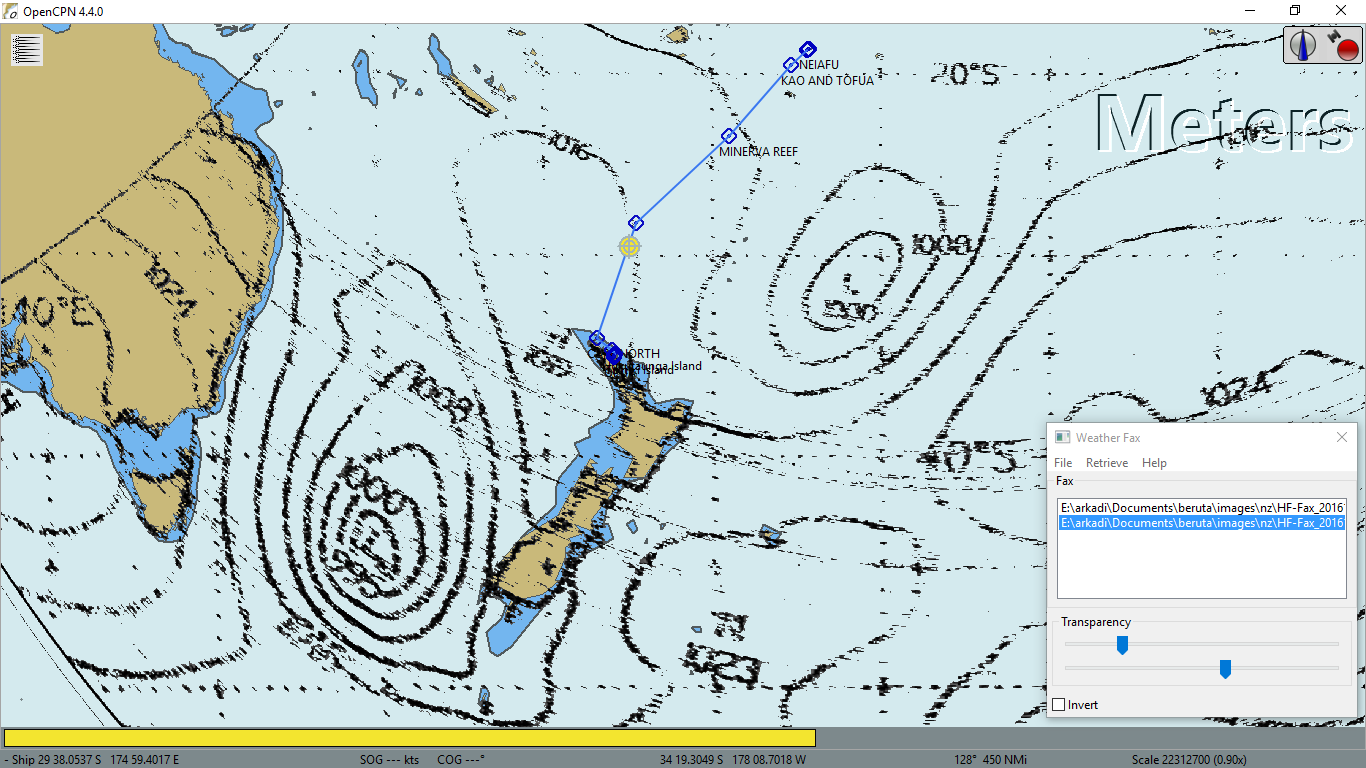 48-hour and
 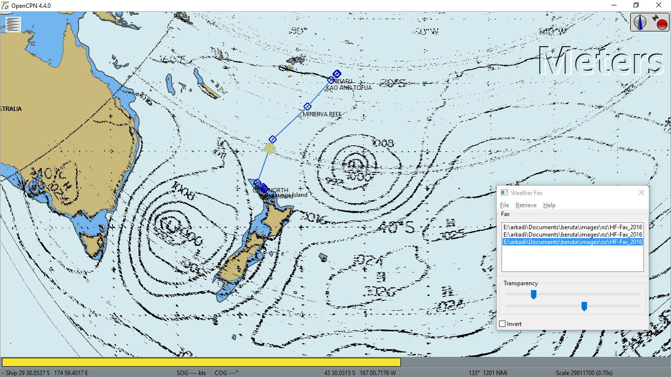 72-hour forecasts. They all were valid for 13:00 local time (UTC+13). As you see from the first two, I would still have light head wind for the next two days. The last weather chart was for Monday, October 24, my arrival date. It looked like I would have NW wind for sometime, which was good. I was afraid of running out of fuel by that time.
At 16:00 I changed the course to 172° M pointing directly to the Bay of Islands. 330 nm to go.
The 13:00 Tasman - New Zealand MLS Analysis (see the chart to the right) showed that the weak front had not yet crossed my route. It should have been very close to me but I did not see any indication of it. The sky and the horizon were clear and there was no wind so far.
As soon as I said it or actually wrote it in the logbook, I went to the cockpit and had another look. Ah, I saw it then: dark clouds appeared in the southwest.

At around 22:00 the south wind increased to 20 kts, gusted 22-23 and that continued for the entire night. I did not want to increase the rpm; therefore, the speed was 2-3 kts, dropping to 1.5 when Beruta ran into a big wave. She was rolling because there were no sails. I could not raise the main without changing the course. The wind was right on the bow. From my experience, I knew that attempting to tack in such conditions did not work. It would take twice the distance at twice the speed, so the net result would be the same in terms of time and a position. It might save a bit of diesel but there would be a great risk of pounding and wrecking the boat.
22 October 2016. Saturday
Not much changed in the morning. The same head southerly wind, 15-20 kts gusting to 22-23. Large waves for motoring at 2,200 rpm through them. Speed 2-3 kts. The sky cleared though. My plan was to wait until I ran out of fuel, sparing 2-3 gallons for the Bay of Islands and docking, then if the wind would still be from the south, tack. Hopefully, by that time it would turn NW.
Today Beruta just passed 87 nm. 258 nm left to the Bay of Islands.
Afternoon the wind shifted to the west a bit and I was able to hoist half of the main sail. It did not work because the angle was 20-30° to the wind but made Beruta roll less. The speed was 3 kts, give or take.
Today the radio faxes looked like these: 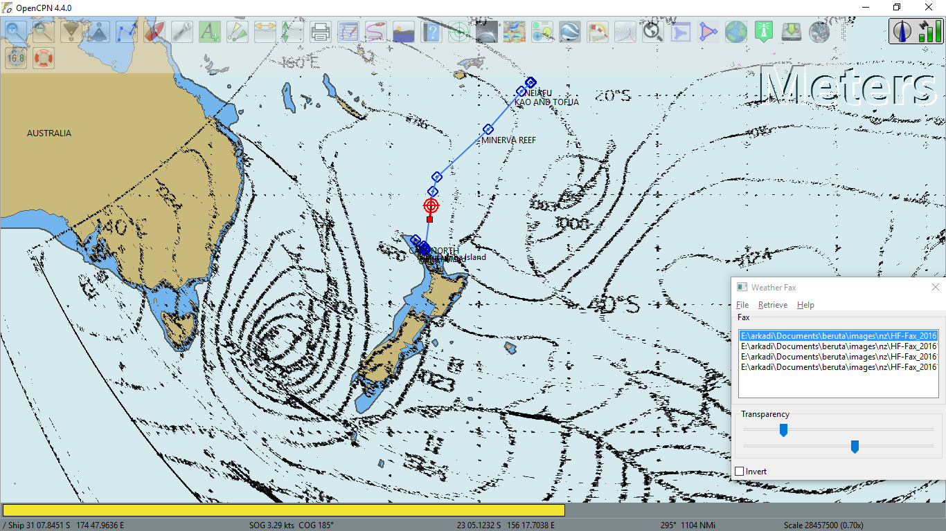 24-hour,
 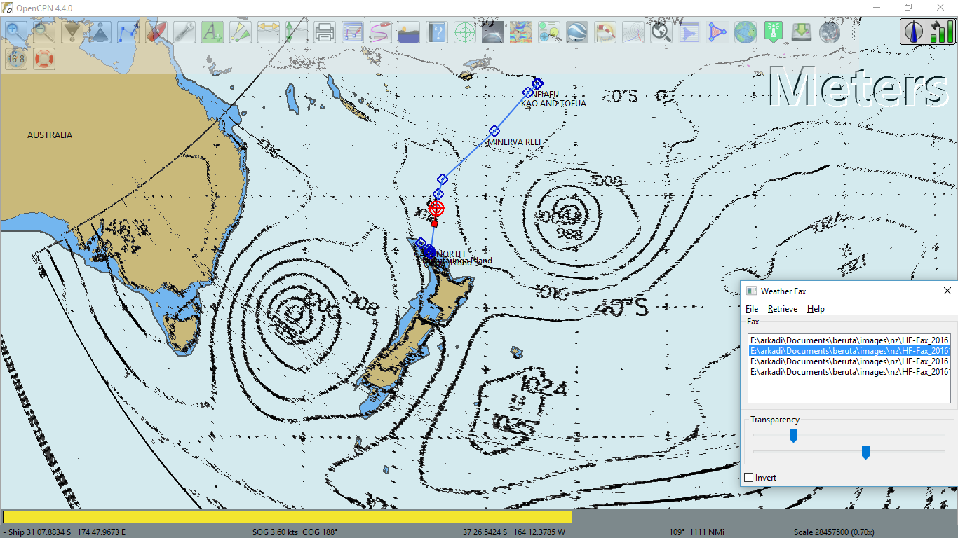 48-hour,
 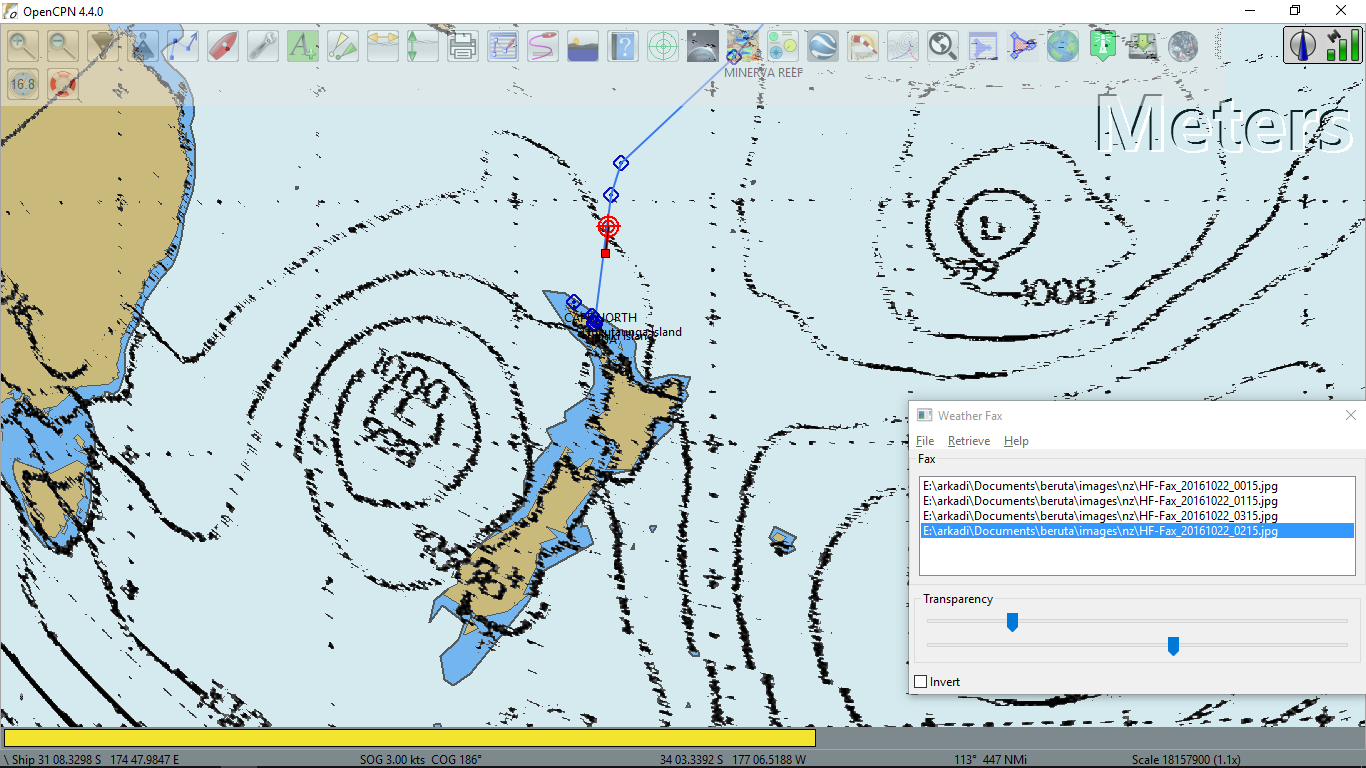 72-hour forecasts. 13:00 Tasman - New Zealand MLS Analysis is shown on the left. There you may also see my position at 16:45. The good news was that the front was delaying till Tuesday, meaning that I would be lucky to arrive to Opua before it, if the forecast were correct.
When I checked the fuel at 15:00, there were 12 gallons left in the tank. At 2,l00 rpm the consumption was 0.35 gallon per hour or 1.6 liter per hour. I added another 8 gallons. 15 gallons at 2,200 rpm should be enough for 42 hours.
23 October 2016. Sunday
The weather was holding, no change, except the wind calmed down a bit but was still SSW. I continued motored with the speed of 2-3 kts. There was the head current again, approximately half knot. 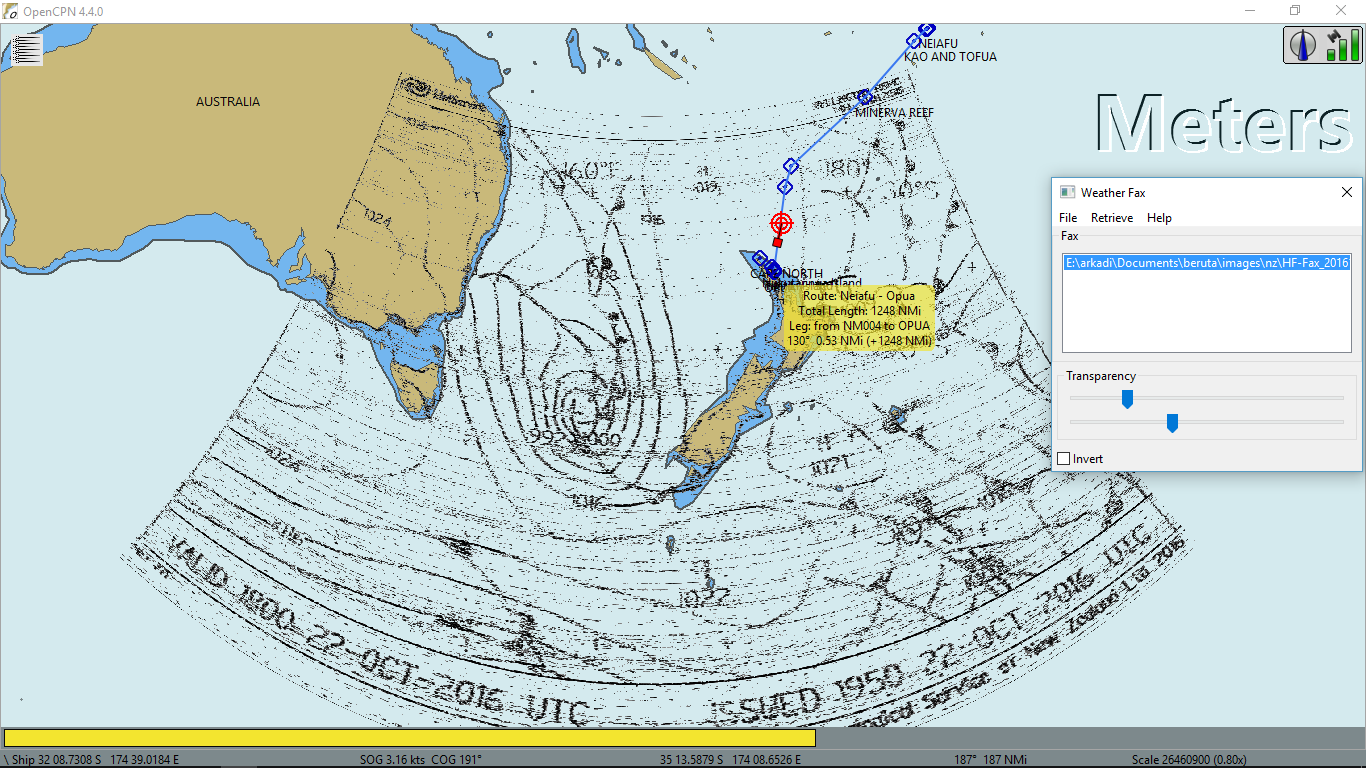 The 7:00 Tasman - New Zealand MLS Analysis from NZ MetService showed that I was in the area of a high pressure. I guessed the unfavorable wind was created by the adjacent low east of New Zealand. The front was coming from the west, which would bring the needed NW wind for a short time before it change to SW again. At noon I saw high level feather-like clouds stretching from the west, indicating that it would arrive in 36 hours or so. Today I set the record low daily mileage for this passage - 74 nm, which made the average speed 3 kts. I was afraid of it being less. 190 nm was left to Opua.
On the chess front, Fritz was doing well this trip, so far I was not able to win a single game! I had chances in almost every game; for example, look at this one shown on the right, where I was playing white. My next move was the winning one but I did not see it. Did you?
At 14:00 wind blew right from the bow. I had to pull the main sail down.
The weather faxes from MetService looked like these: 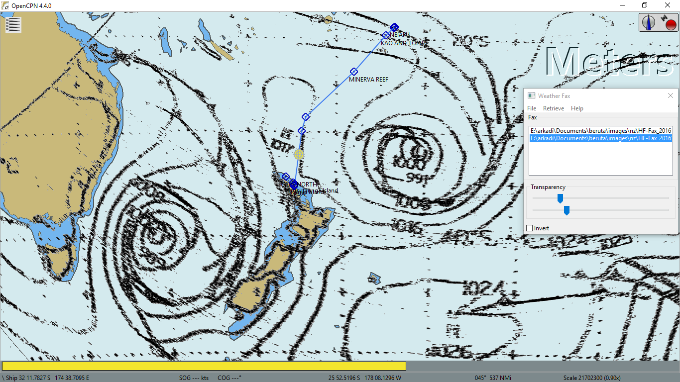 24-hour and
  48-hour forecasts. I was not able to receive 72-hour forecast. Someone up there decided that I did not need it. Tomorrow I might still have south wind, damn it! The fuel would finish around 9:00 tomorrow, so I might begin tacking. From the 48-hour chart you may see that the low would still be going to be on the west of New Zealand and according to the isobars I would still have NW wind October 25 at 13:00. I hoped to be in Opua by that time. At least, there wouldn't be any SW wind prior to my arrival from that low.
Speaking of temperature, I had to use my sleeping bag rated to -20° C at night and wear Gill foul weather gear when I went outside the cabin. During a day, it was warm in the sun if I was behind the pilot house but the wind was really cold outside of it.
The fuel was coming to the end sooner than I had anticipated. At 17:00 there were only 7 gallons left in the tank. I added the last 3 and stopped the engine. I began tacking. At 11:00 the wind became very light and neither autopilot, nor windpilot were not able to cope with such conditions. I had to steer manually.
24 October 2016. Monday
At 1:30 the wind became less than 5 kts and I gave up. I decided to burn another 2 gallons at 1,800 rpm for about 6 hours and have some sleep meanwhile.
I woke up at 5:30. Beruta was rolling and the wind was 10 kts from the east! Yeah, I did see the bend in the isobar caused by the low at the east of New Zealand. I hoisted main and genoa and stopped the engine. By 9:00 the wind shifted to the north and died. I agreed to run the engine for another 3 hours.
Here was how 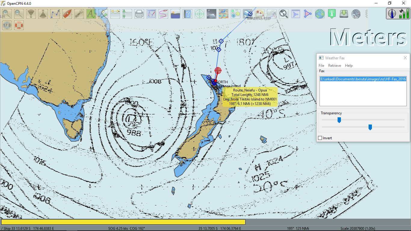 the synopsis looked like this morning. You may also spot my position at 11:00.
 13:00 o'clock barometric picture for tomorrow showed that by noon the front would pass over me. According to isobars, the wind would not change sharply in my location. At worth, it could shift to the west from NW, which wouldn't be too bad.
The main problem was that there was still no wind and no more fuel to burn. There was 110 nm to the Bay of Islands and 10 more to Opua. I needed 5 kt speed for the next 24 hours to get there afternoon before 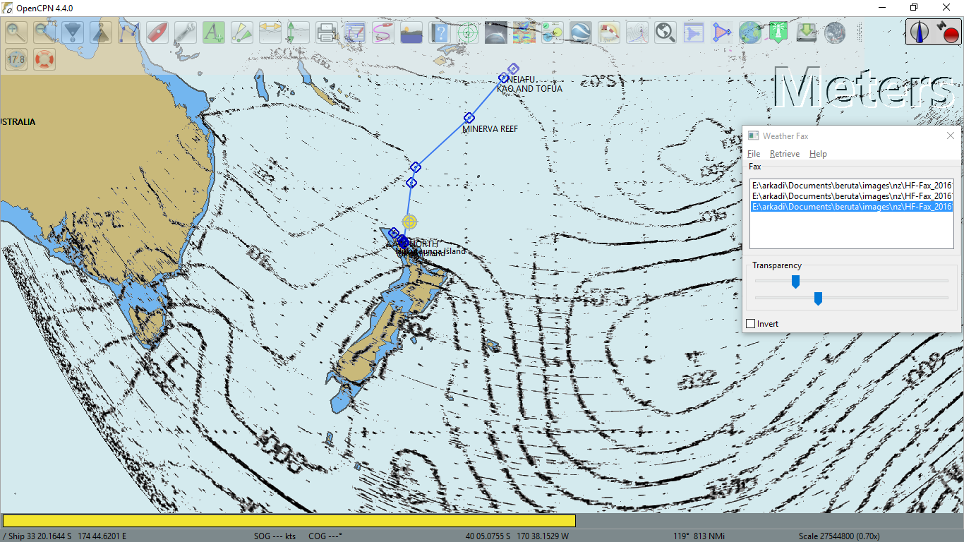 the center of the low moves over New Zealand on October 26. Then the wind would definitely be SW.
While waiting for the wind, I cleaned my food shelves and boxes in a preparation for the "kiwi" biosecurity inspection. Many products were not allowed, so I had to throw those overboard.
They turned the wind on at 20:30, thanks God! 8 kts blew from the north. The wind gradually improved to 10-15 kts. Beruta was running at 4-5 kts under main sail with one reef. The blocks at the top of the mast did not allow me to hoist the full main. Well, I could do it but then somehow the sail jammed the topping lift. Anyway, I expected the wind to increase further, so one reef was safer.
I switched to the windpilot. It worked better for running down wind and prevented accidental gybing.
25 October 2016. Tuesday
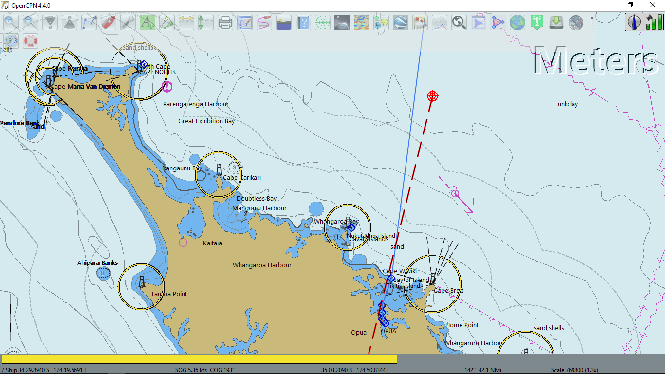
Opposite to my expectation, the northern wind decreased to 8-12 kts by the morning and the rain began. The speed was around 4.0 kts. At 9:30 it was 52 nm to Opua. My ETA was 22:30 unless the wind changed. At this latitude this time it was getting dark at 21:00. I heard that it was ok to arrive at night to the customs pontoon, which was a floating breakwater of the Opua marina. The Bay of Islands was supposed to be wide with good navigation lights.
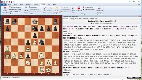
Another chess game with Fritz and excellent winning chances, actually with 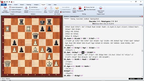 the position shown, there was a mate in 8 moves for black, which I did not see. I lost at the end when there was a drawing solution.
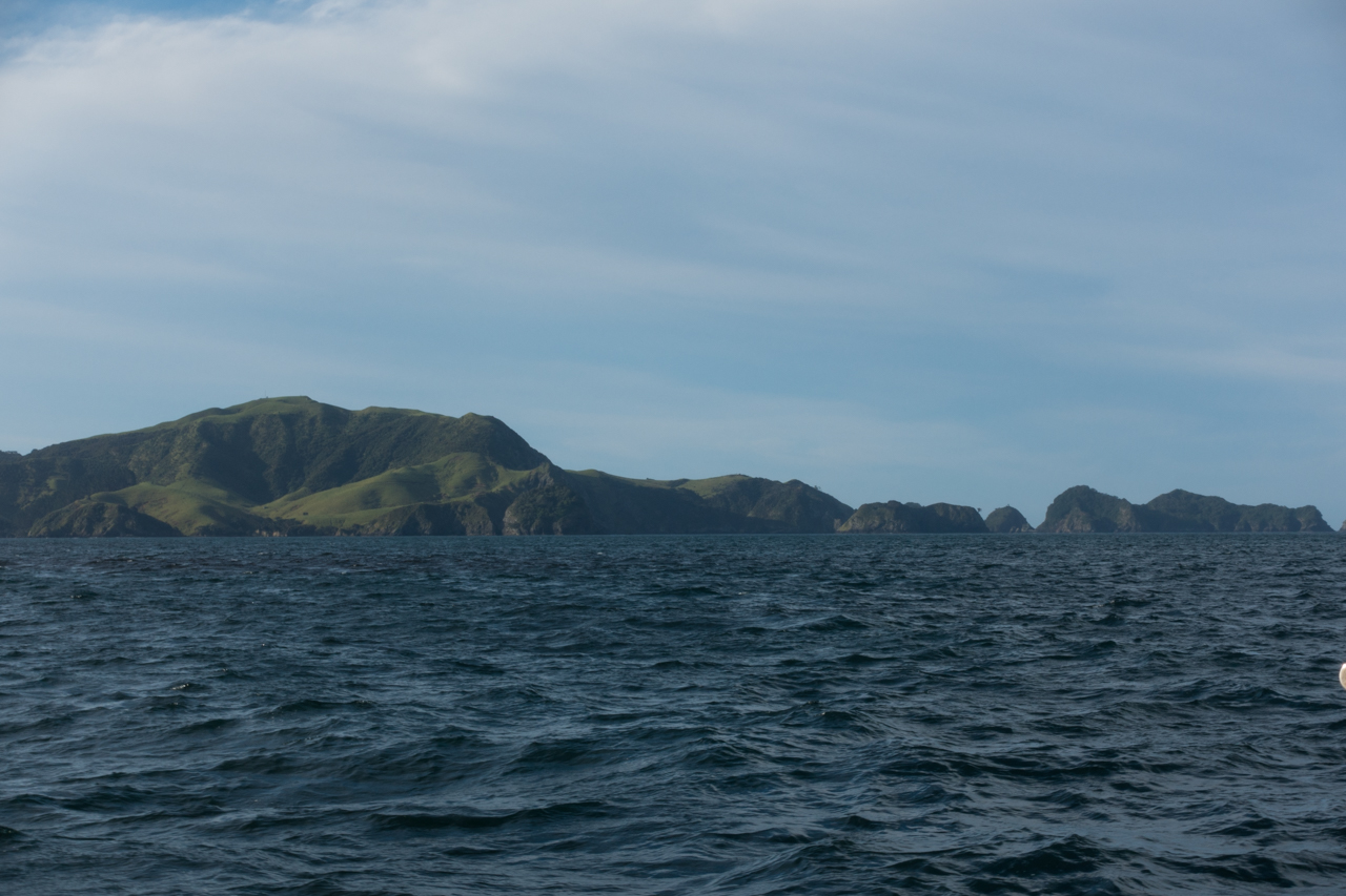
Later in the day, the wind did pick up and was blowing 15-20 kts from the north gusting to 25 apparent. I was running on the portside, waiting till the front passes and the wind changes to the west and I would not need to gybe. Of course, someone was pulling my leg up there. The wind instead of shifting to the west, began shifting to the east! I resisted to gybe to avoid another gybing and I was changing the course. I was already too far off track, so I gybed. 30 minutes after the sky cleared up and the wind changed to the west. I had to gybe again! The front passed and I saw New Zealand! I was about 20 nm to the coast. I set the jib and was reaching at hull speed, making over 6 kts.
I tried to VHF Maritime Radio to update my ETA for the customs and biosecurity but I was too far offshore, 10 nm or so. I made another attempt from 6 nm. It appeared that they heard me because there was some noise on the radio as would they answer my call. I said that I did not copy them and ask them to relay my 20:00 arrival time to Opua to the customs. When I was almost near the Bay of Islands, I heard Whangarei Maritime Radio calling other boat. I spoke with them. They had copied my message and hopefully informed the customs of my ETA.
At 17:00 I entered the Bay of Islands. It was 10 nm more to Opua. I switched the windpilot to the autopilot and kept sailing.
At first, it seemed that all were the rumours about New Zealand - the sailing capital of the world but the deeper I was inside the bay, the more boats I saw. At the end I did agree. It was almost like French islands in the Caribbean. Boats were everywhere and many of them.
When it was 3 nm to Opua, the wind died and I motored the rest of the way to the marina. There was about 1 kt head current - from the river, I supposed. I arrived to the customs dock exactly at 20:00, just after the sunset. I tied Beruta and went inside the cabin to have supper. I guessed the officials would come tomorrow.
Therefore, it took me 12 days and almost 8 hours to cover 1,268 nm. The average speed turned out to be 4.3 kts.
All pictures from Opua will be in Google Photos.